Latest Image of Hunza Gojal Landslide lake by NASA showing the water level and the length of the lake reaching from Gulmitt to LandSlide point about 10 Kilometrs. This image also shows the sno has been meted from the mountains while the white areas on left and right are snow capped peaks of Karakorum mountains.
Latest Image of Hunza Lake from NASA

Old Image of Nasa Showing more snow on the lower level of mountains.
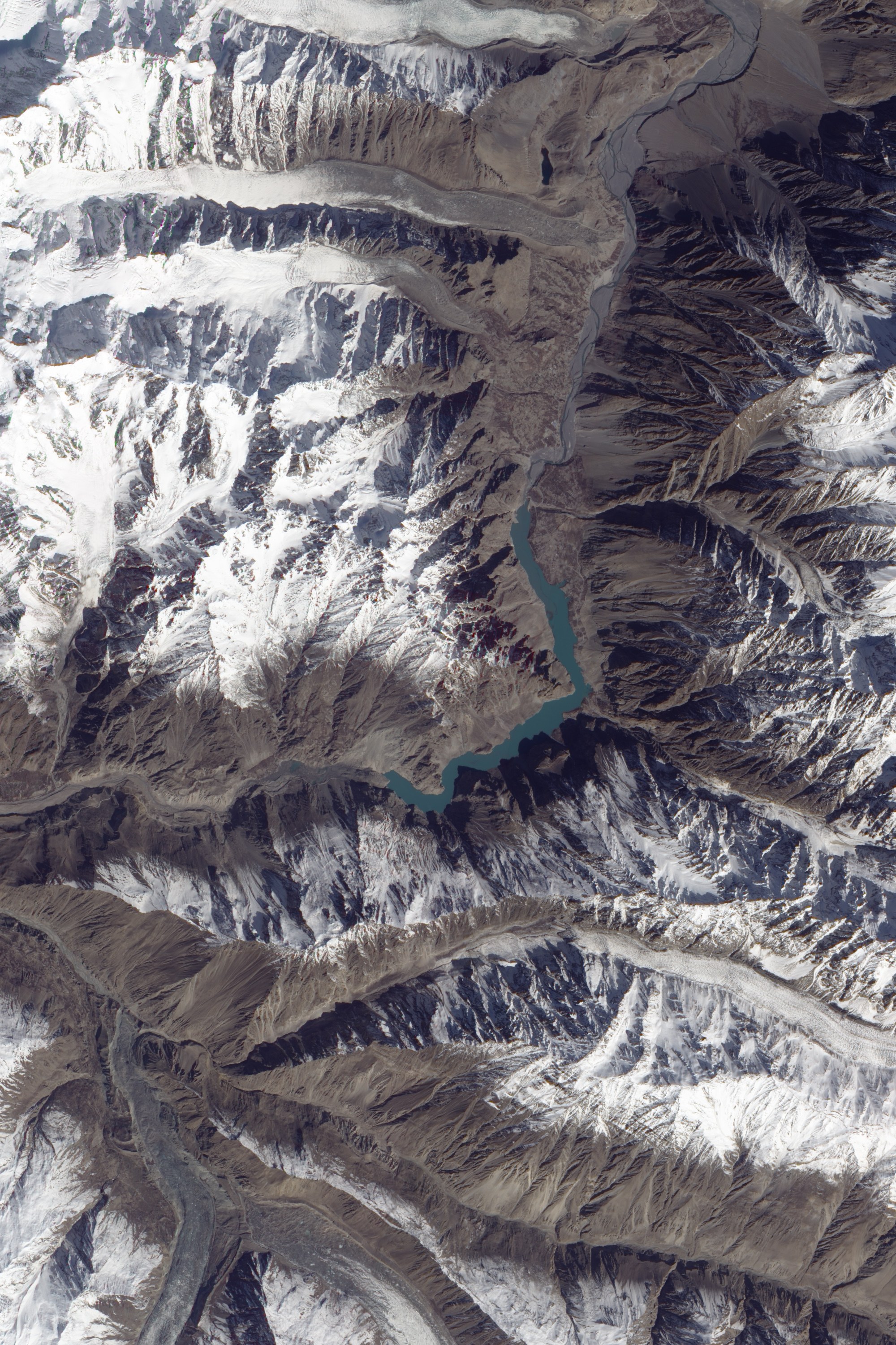
On March 16, 2010, the Advanced Land Imager (ALI) on NASA?s Earth Observing-1 (EO-1) satellite captured this true-color image of the lake created by the landslide of January 4. (Note that north is on the right.) Dark rock covers the river in the upper left corner of the image, and the turquoise V-shaped lake stretches out behind the slide. Near the temporary lake, the Karakoram Highway is a faint meandering line of pale brown. A bridge across the Hunza River has been submerged by the rising waters. The bridge connects the settlements of Shaskat (or Shiskit) and Gulmit on the region?s only route to and from China.
Besides displacing some 1,500 people as it flooded their homes, the lake cut off everyone between Attabad and the submerged bridge?an estimated 3,000 people?from the outside world, according to news reports. Chinese engineers had begun working with members of Pakistan?s army to carve a spillway through the landslide by late January, but the size of the landslide made for slow progress.
Geologist & Expert in Dam Disasters Dr. David Petley reported that, as of January 25, the lake?s level was rising roughly 1.1 meters (3.6 feet) per day, and as of February 10, water was rising roughly 60 centimeters (24 inches) per day. By March 11, water was seeping through the rocky dam, likely from the newly created lake. The seepage raised fears that the water might breach the dam and flood villages downstream.
))")